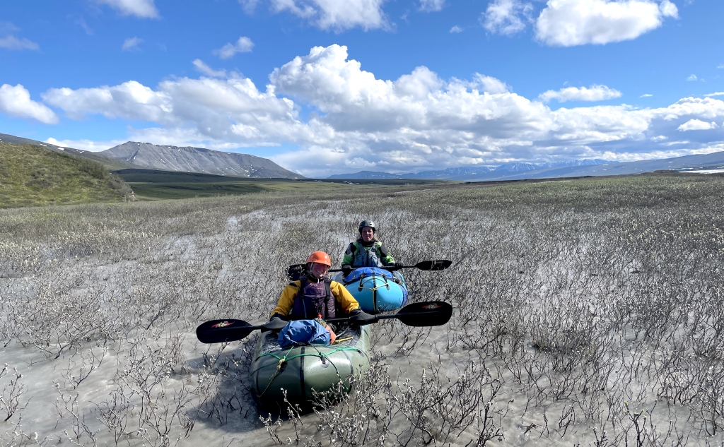
Packrafting the Marsh Fork and Canning River Alaska

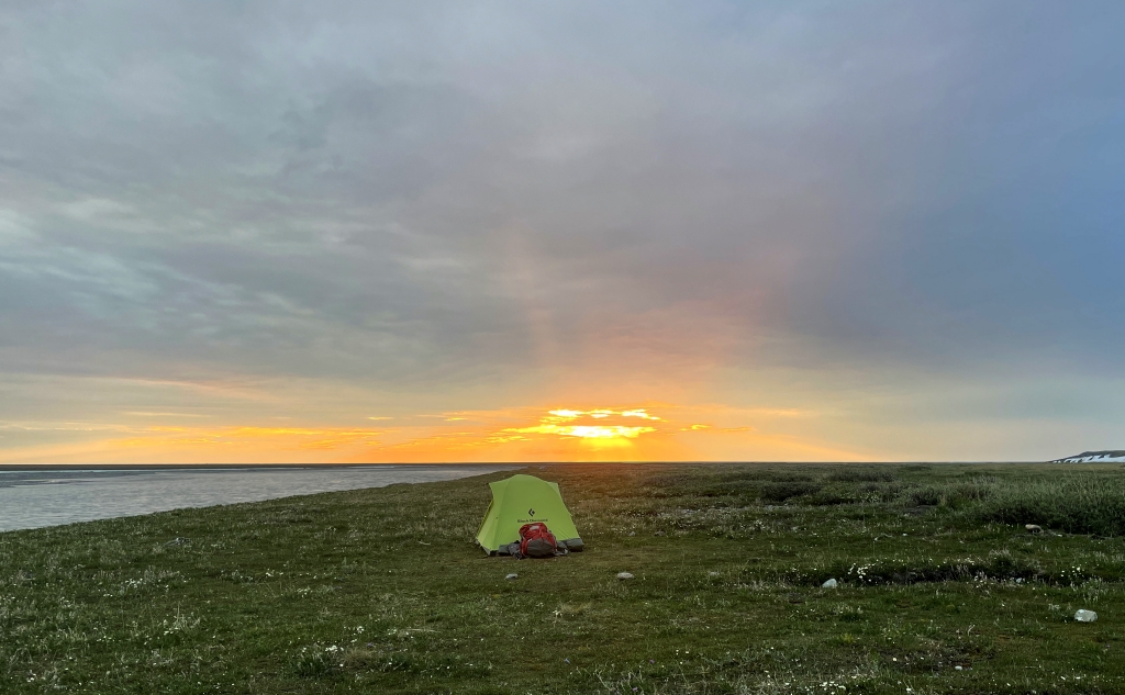
In June of 2022 we embarked on an adventure that had long been a bucket-list item of ours: to raft from the Brooks Range north to the Arctic Coastal Plain. Our route would take us 100 miles down the Marsh Fork of the Canning and continuing on the Canning River to it’s delta on the Arctic Ocean. This was a self-supported 14-day trip that involved traveling by packraft and by foot whenever necessary due to conditions. Our timing was dictated by our desire to travel before onset of mosquito season, but just after the breakup of winter ice on the rivers.
We honor and acknowledge the Indigenous peoples, nations, and traditional territories of the lands in which we traveled. These include the traditional territories and ancestral homelands of the Gwich’in and Koyukon Athabascan peoples.
Days 1 & 2: Marsh Fork Upper
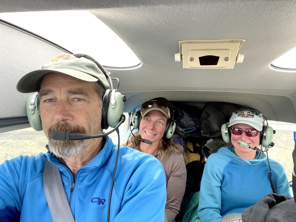
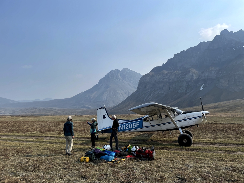
Our original plan was to fly direct from Fairbanks to the upper reaches of the Marsh Fork. Unfortunately, smoke from massive wildfires in western Alaska had enveloped most of central and northern Alaska imposing flight restrictions across the state. At his Fairbanks hanger, Kirk – pilot and owner of Yukon Air Service – informed us that it was doubtful he could fly us out the next day. Assured that he was working on an alternate plan, we woke at 6 the next morning to the sound of a text message indicating we needed to be at the Wright Air terminal in 20 minutes. After a bit of frantic packing, we loaded into a commuter flight to Fort Yukon where visibility was reported to be better. Meanwhile, Kirk flew separately with our gear to meet us there.


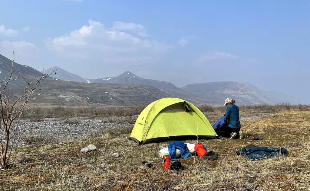
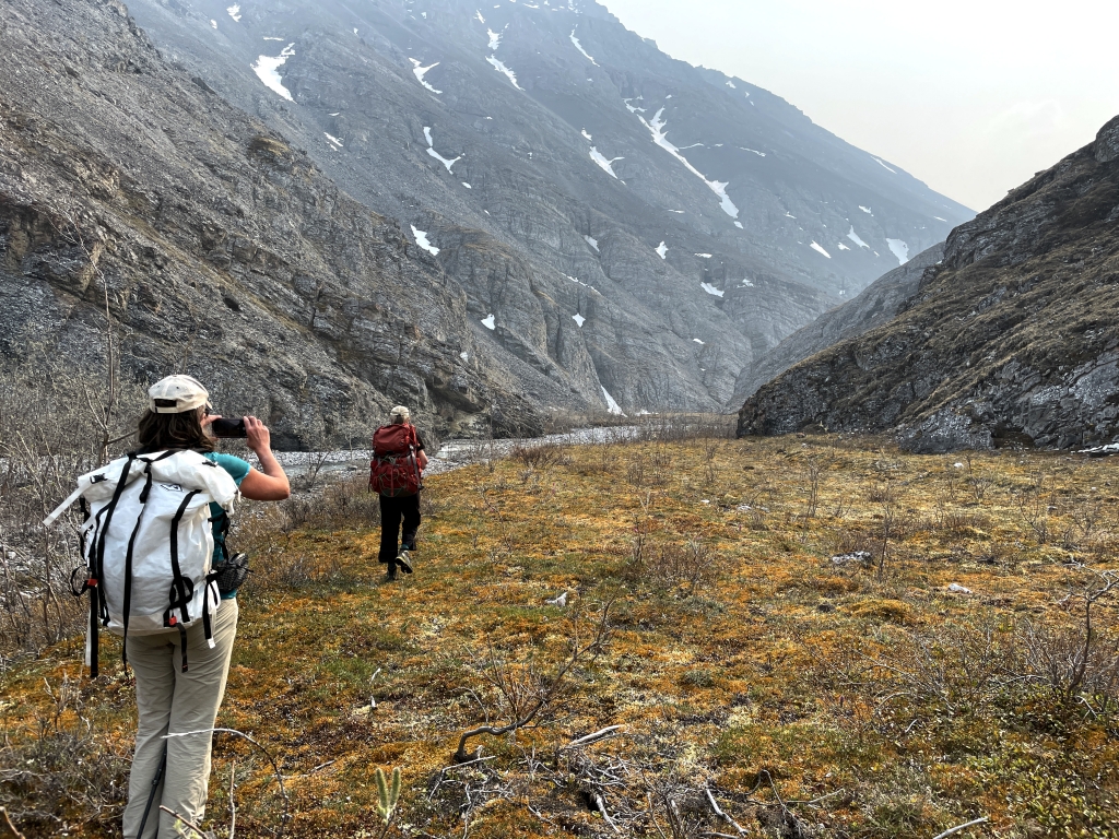
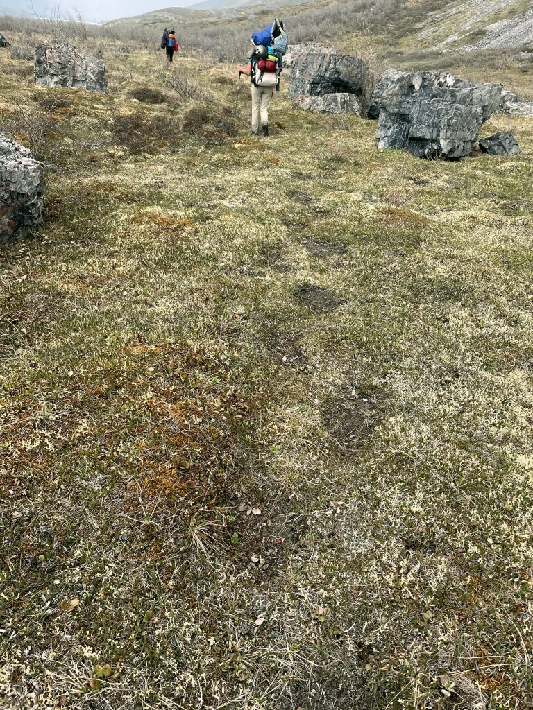
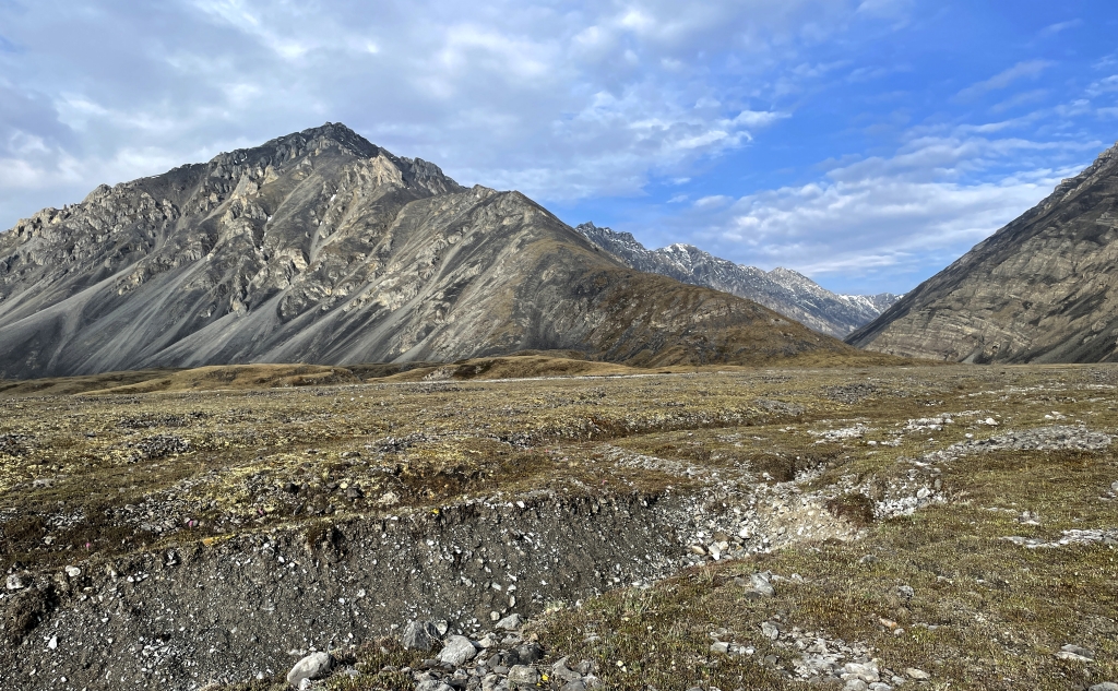
Day 3: Backpack to Lower Bench
We anticipated that the upper section of the river would be too low to float and still mostly iced in with the seasonal pack ice (aufeis). Therefore, we were prepared to hike downstream until we reached an open channel with ample flow; our best hope being the area around the “Lower Bench” landing strip about 7 miles away.


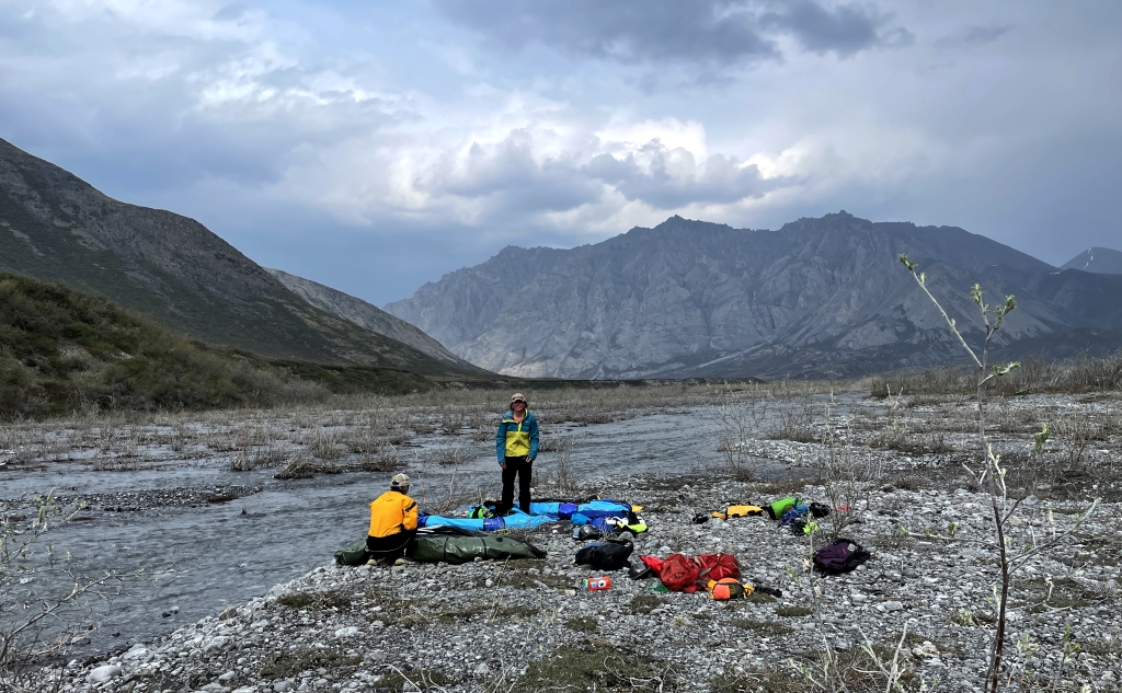
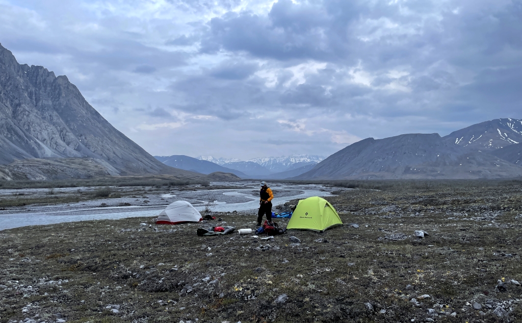
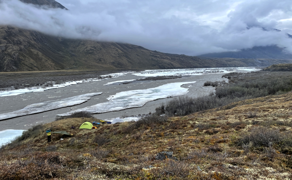
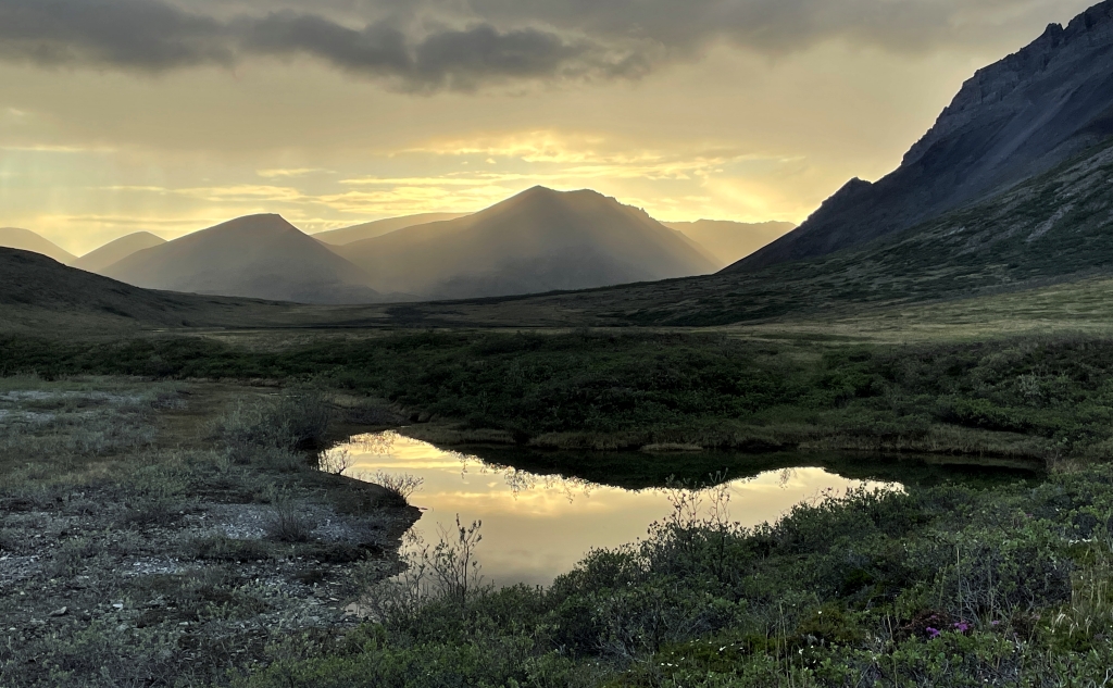
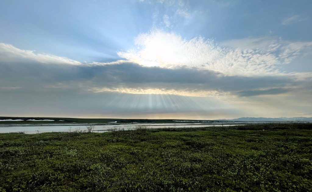
Days 4 & 5: Launch and Day Hikes
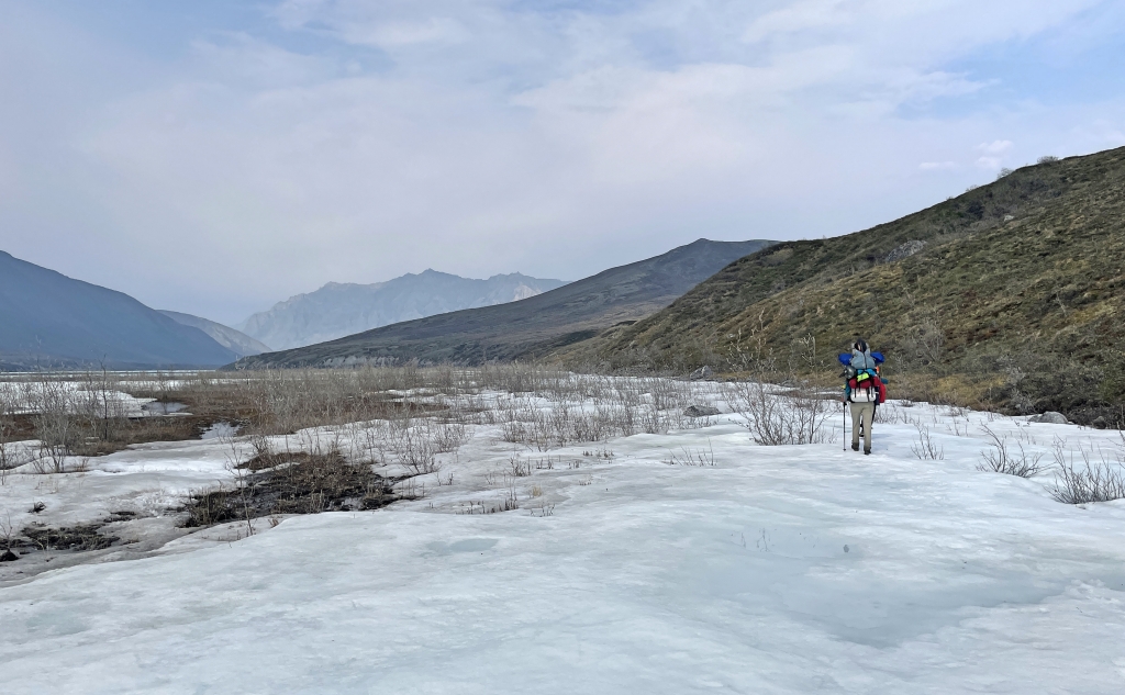
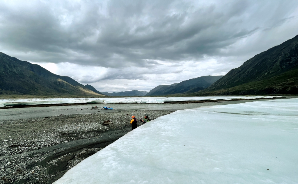
The evening before we ended our hike on a bluff just upstream of the Lower Bench airstrip which was already occupied by a guided group (one of only two other groups we saw during our entire two weeks). From our camp we could see near continuous aufeis across river channel though it appeared to be thinning out toward far shore and downstream. Satellite imagery from a few days before our departure also hinted at flowing water on the far side.


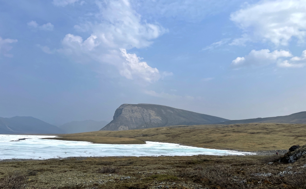
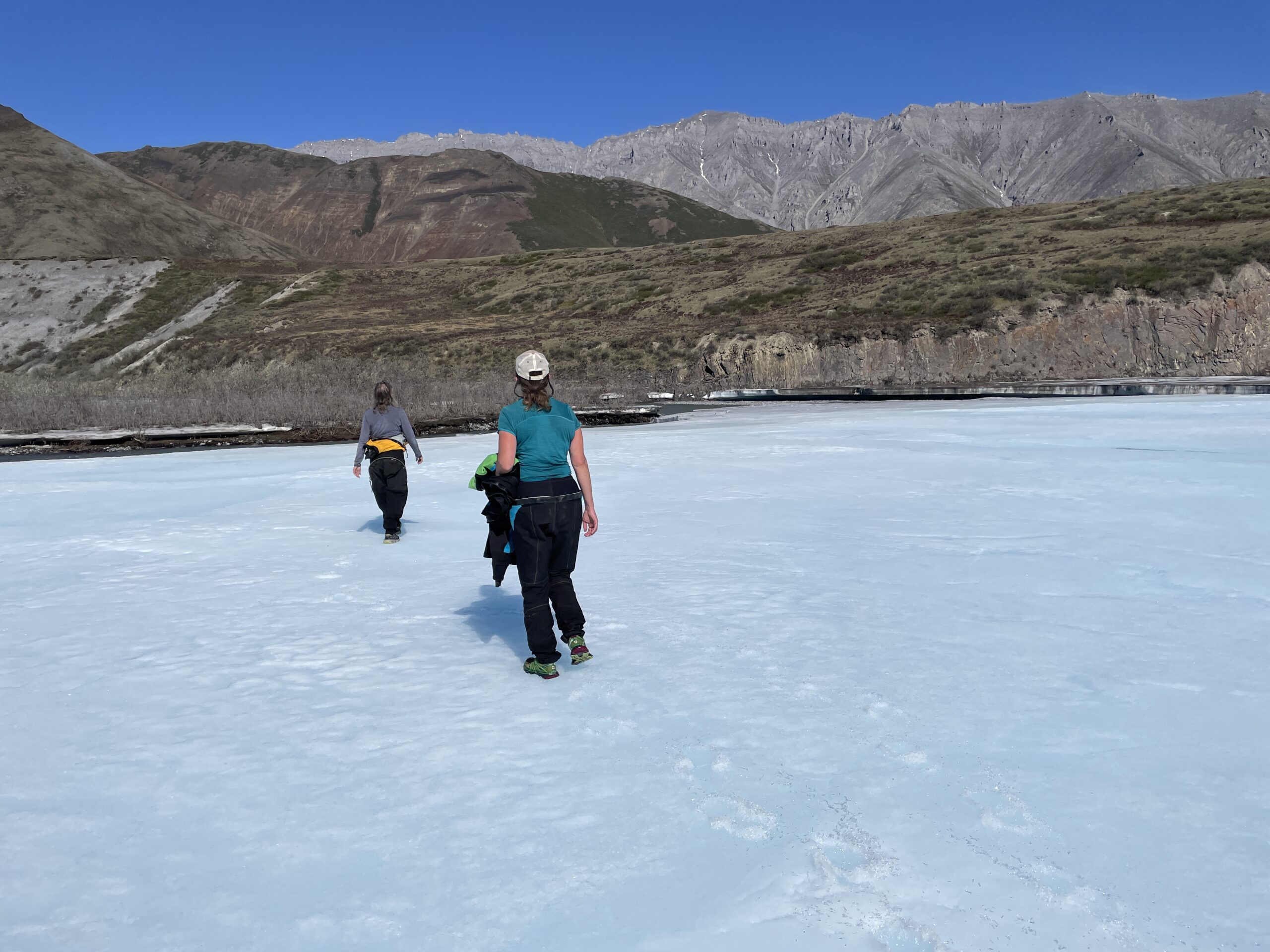
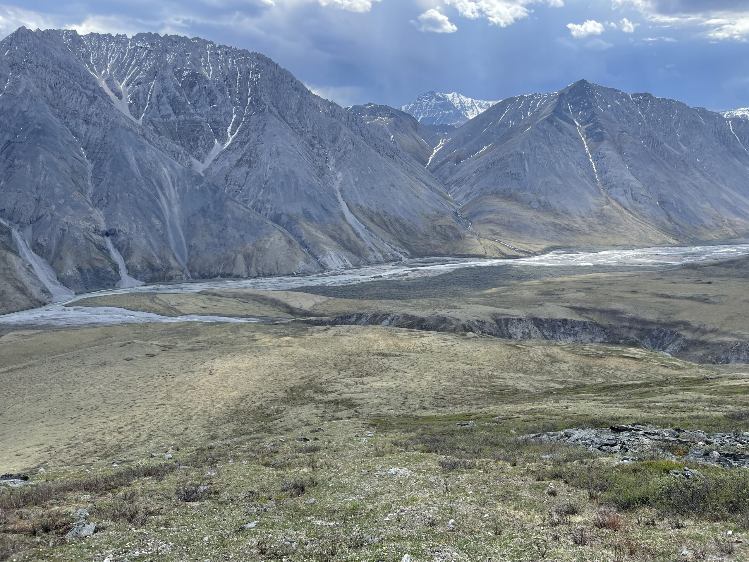
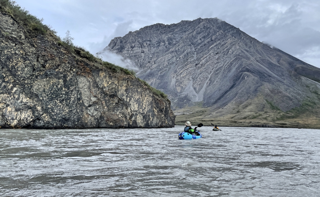
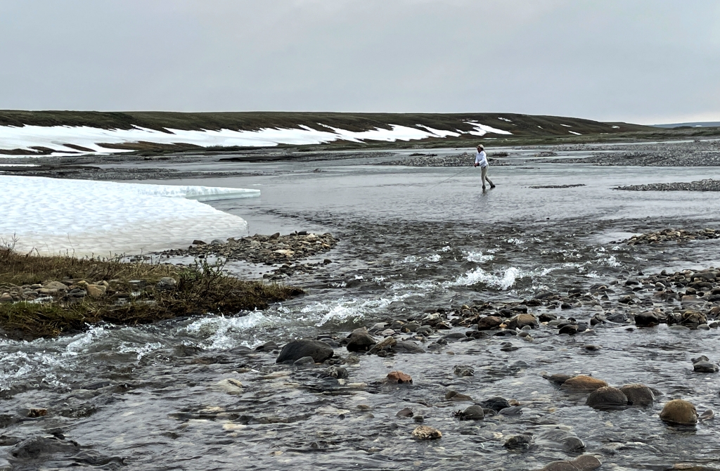
Day 6: High Water and Aufeis
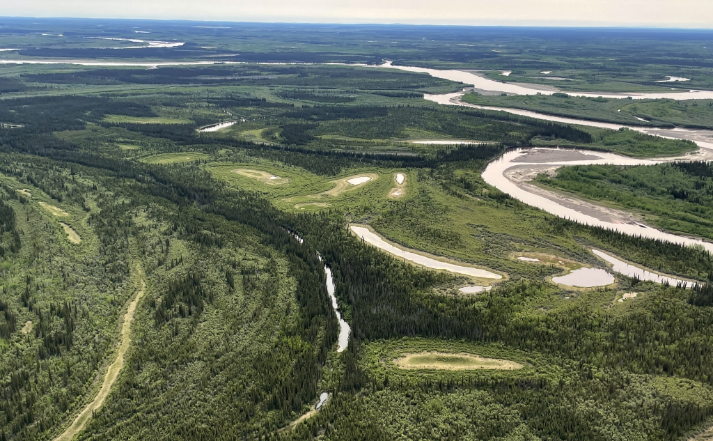
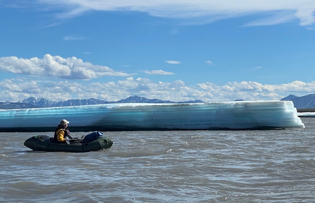
In our trip-planning we had been tracking the river conditions using various sources of satellite imagery. I especially relied on the Sentinel imagery as it has high enough resolution (10m) to see major features and river channels and has infrared capabilities to help identify vegetation growth, ice, and water. (I cover my planning process in much greater detail in a separate post.) As our departure date grew closer, I carefully mapped out the sections of river that I felt may be a problem, noting some long stretches where aufeis had not yet broken up. Our greatest fear was rafting a flowing channel cut through the ice and having the river then disappear into an aufeis tunnel. We knew we would be on the edge of the ice-breakup so we were prepared to scout anything that looked suspicious or didn’t feel right.
This day brought heavy rain, sleet, and rising water indicating that breakup was in full force. Stretches of the river that I mapped as boulder-gardens were fully covered in water resulting in long stretches of standing waves and rapids. Though none of the rapids were above Class III, the occasional iceberg and lateral waves from collapsing ices shelves made for some bonus challenges.


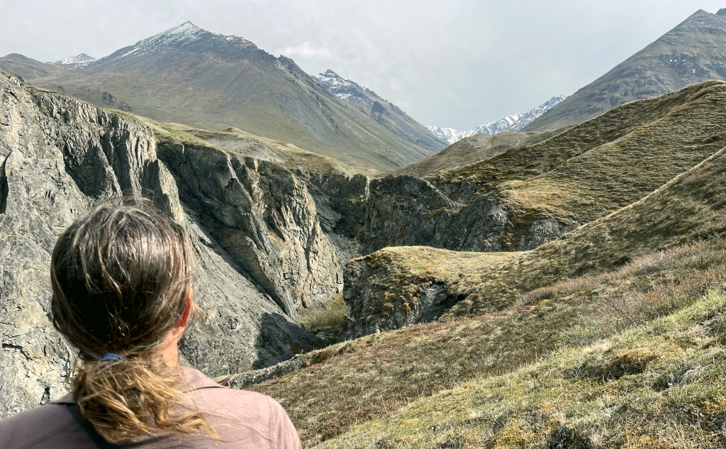
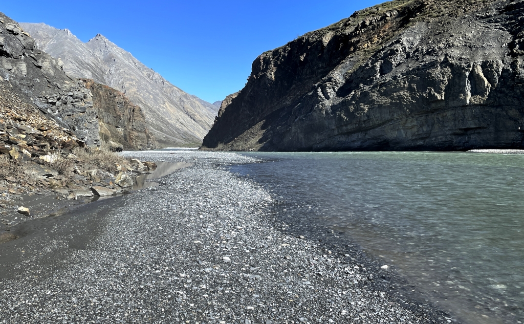
Day 7: Box Canyon
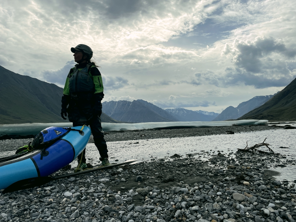
The next morning revealed a different river than the day before: though the water was still high, there was noticeably less aufeis and a large ice-dammed pond across the river had broken free and drained. We launched our rafts from a shore-side ice-shelf and cautiously made our way. Occasional rain showers followed us downstream, but the river level appeared to be dropping.


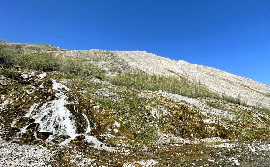
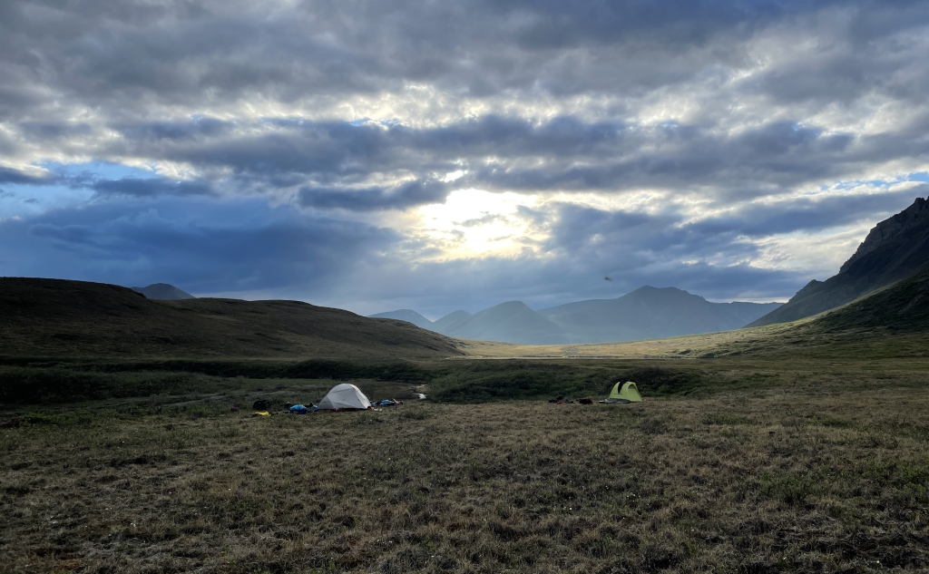
Days 8 & 9: Salisbury Creek and Hiking
Generally, the Marsh Fork is considered Class II with a few Class III rapids depending on conditions. Nevertheless to avoid any surprises, our pre-trip research included not just mapping the ice conditions but also the known rapids. The next stretch was reported to have a potentially challenging Class III rapid as the river runs into a rock wall and makes a hard right turn. This would be quickly followed by a canyon section which was described as being either totally innocuous or very hazardous depending on which account you read. As we approached this section, we found that the river was diverted by thick aufeis and curved before wall section disappearing out of view to right. No longer concerned about the rapids, we were now concerned about the aufeis and canyon beyond.


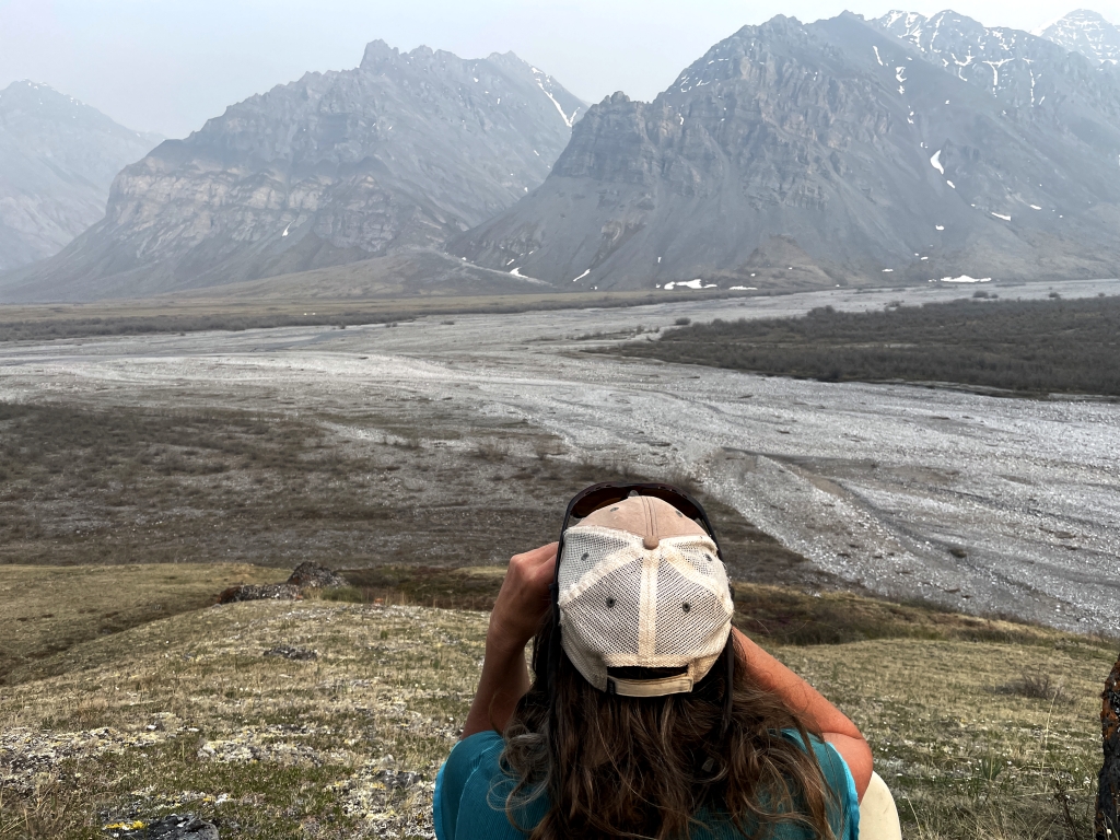
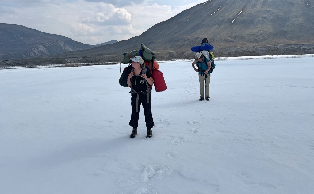
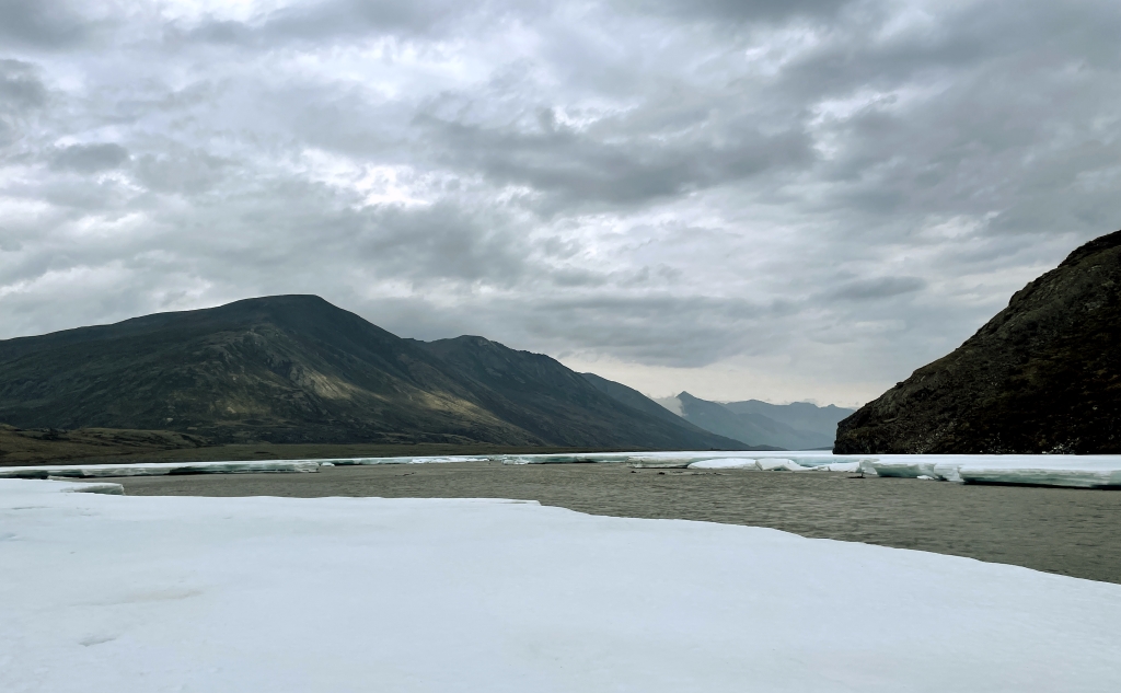
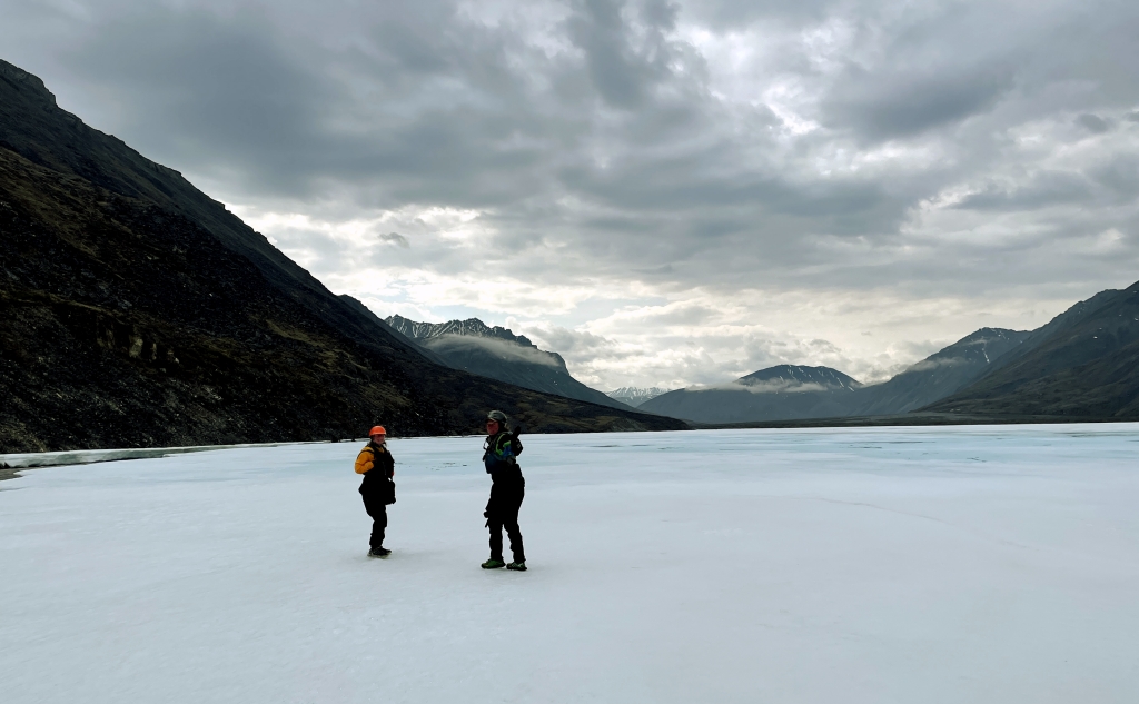
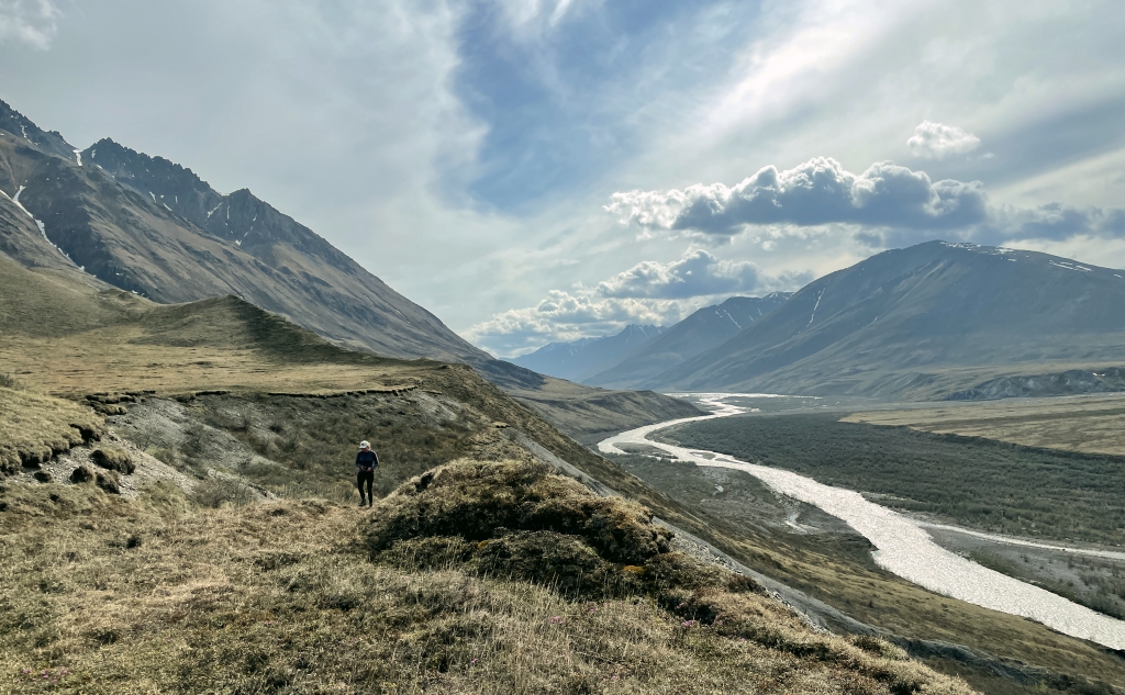
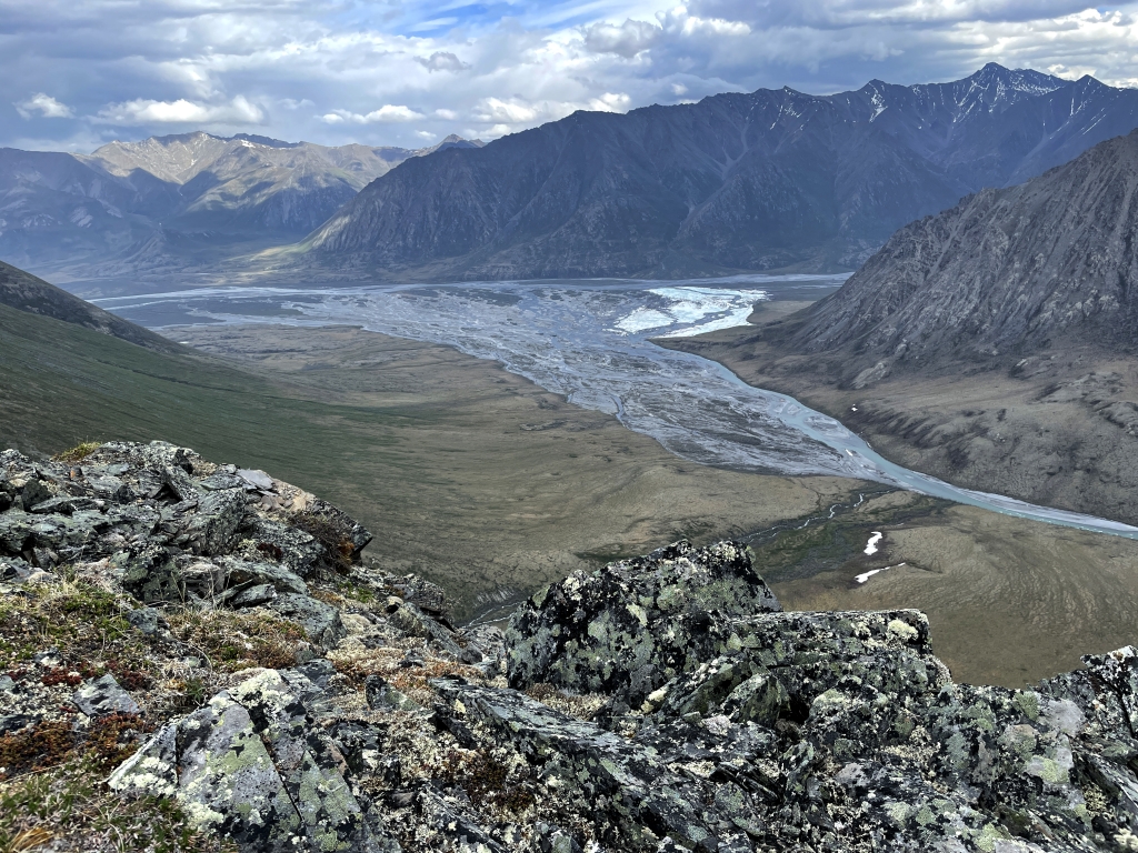
Day 10: The Confluence & Bench Lake
One of the anticipated cruxes of the trip was the Marsh Fork – Canning confluence; a broad braided delta which in some years can be blanketed in aufeis, the confluence can be challenging to navigate and in some cases require an extensive portage.


Days 11 & 12: Canning River
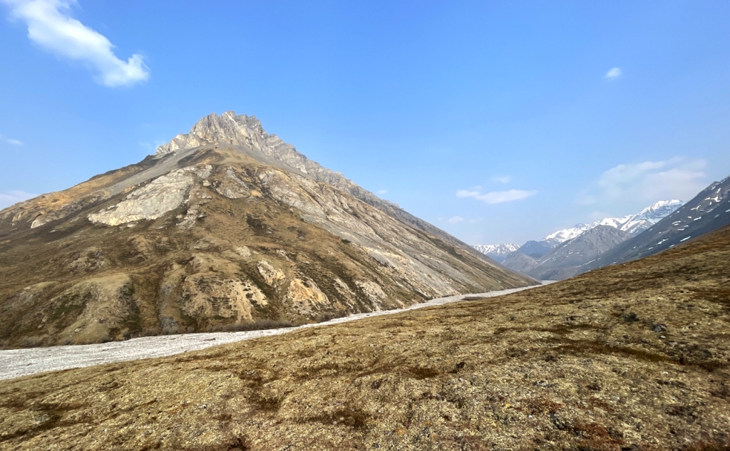
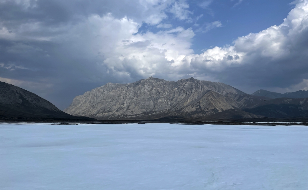
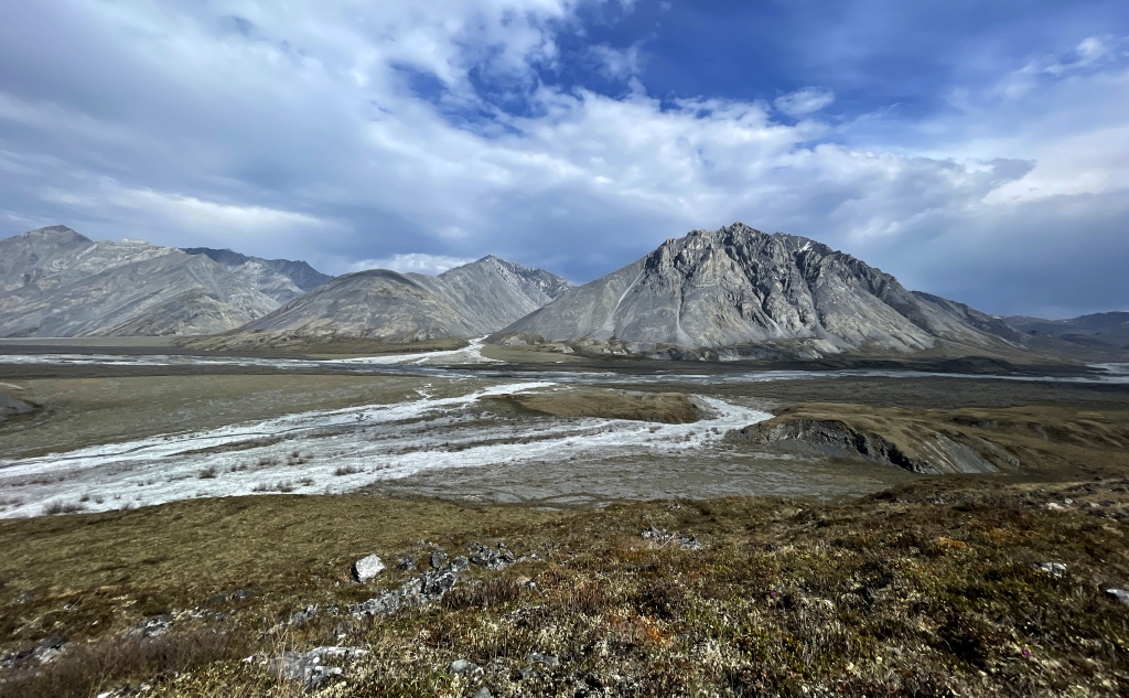
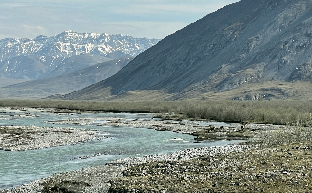
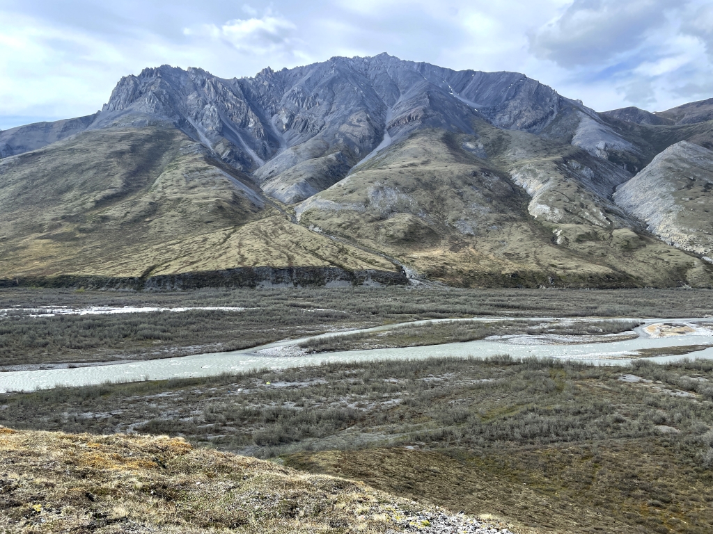
Continuing down the Canning, we emerged from the Brooks Range passing to the west of the foothill ranges including the Third Range separating the Ikakpuk and Ikiakpaurak valleys. The Canning in this stretch flows rapidly but without any major rapids. Our challenge continued to be navigating the aufeis channels while keeping a reasonable distance from the collapsing ice shelves. We mostly followed the channels as I had mapped them prior to our trip, but now it was almost two weeks later and it was obvious that the conditions here change by the hour. In a section between Cache and Ignek Creeks it appeared on the imagery as though the river had significantly eroded the eastern bank and my route cut through what, on older maps, is shown as high tundra. Upon reaching this section the actively eroding tundra banks and submerged willows testified to a newer river course as did a newly formed large Class III rapid that caused us to portage through a willow swamp.
At the time of my pre-trip planning, I had struggled to map any obvious channel from this point for about ten miles downstream as, it appeared as though the entire river channel was flooded. Floating through this section confirm my theory of a flood – likely caused by an ice damn at a constriction downstream. Fortunately the water had drained, but we found evidence of the magnitude of this flood with large blocks of aufeis stacked on top of each other, gravel dredged and scoured by moving icebergs, bent vegetation, and woody debris high on the tundra bench adjacent to the river channel.


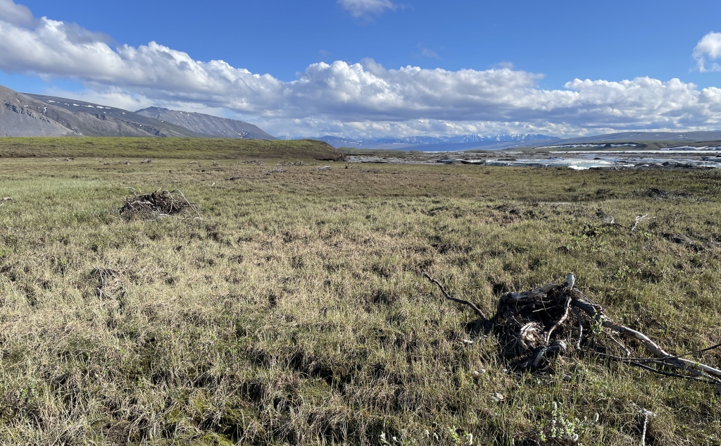
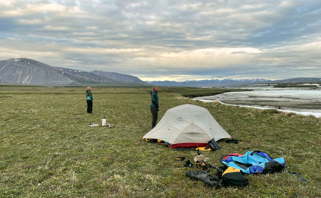
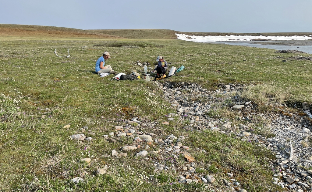
Day 13: Detritus of Progress
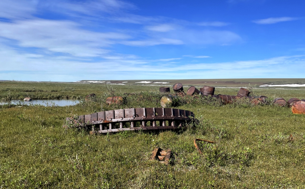
We were now in the heart of the Arctic Coastal Plain and the river continued to pass through patches of aufeis. Thankfully, the channels were larger and the concept of being sucked into an aufeis tunnel was becoming remote. We were traveling fast but in no hurry to reach the end of our journey, so we pulled in to camp at the outlet of a small creek draining an low bench on river left. Climbing up the river bank were surprised to see immediate evidence that the west side of the river is not part of the Arctic National Wildlife Refuge. In the middle of this bench was a small pond surrounded by a stack of rusting metal drums and abandon tractor treads
A closer look revealed most of the small ponds in this area were filled with oil exploration detritus as were any other low ravines and willow clumps. This was a stark reminder of the lack of respect that past exploiters have for this amazing environment. It is not a stretch to consider that these items of “progress” will remain here for generations as a reminder of the permanence of human hubris.
In some respect this was an appropriate place for our last night on the river. We were simply visitors here and perhaps we didn’t belong here either. Although our group tried to keep our impact minimal, we can’t help but have some affect regardless. Later that evening we watched two grizzlies, one young and one old, on the far bank foraging. Although I measured this as almost a mile away, they appeared to quickly realize our presence and the older one immediately ran over the bluff and disappeared only to be joined a short while later by the younger one.

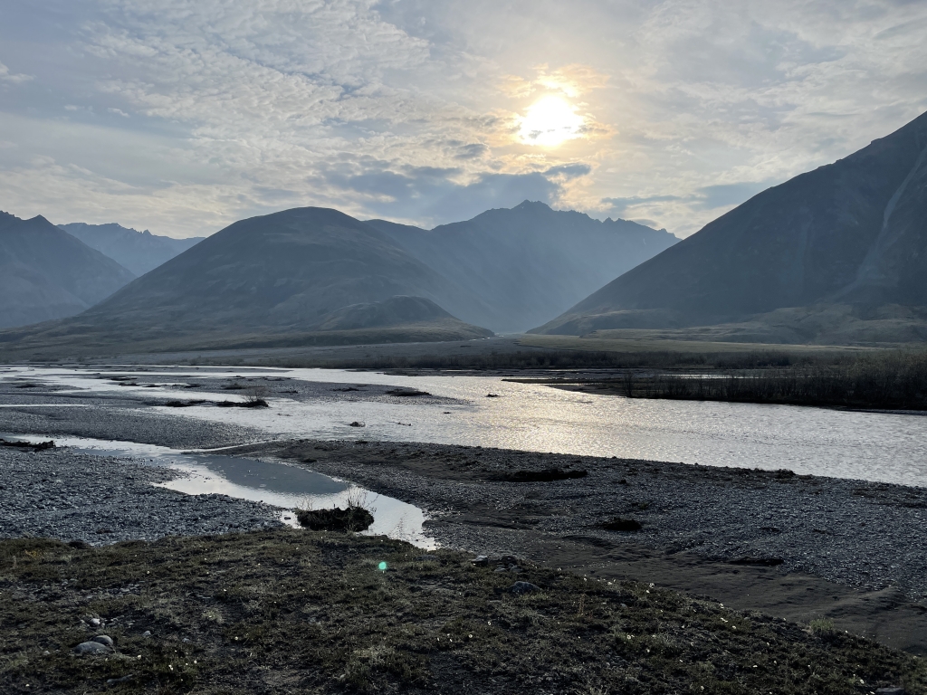
Days 14, 15, & 16: Take-out
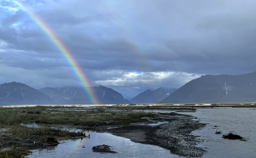
Spring was in full force on the coastal plain; sunny skies and warm temps greeted us on our last day on the river. We were a bit nervous of missing the take-out, diligently tracking our progress on our GPS’ but it was quite obvious when we got there. After baking in the heat of the sun in our drysuits we took a quick dip in the river which quickly reminded us that this river water had been ice a very short while ago. The airstrip sits on a large, flat tundra and gravel bench a dozen feet above the river. The airstrip itself is simply two vague strips of gravel the width of the aircraft tires. Surrounding this, the bench was filled with blooming wildflowers and noisy ground squirrels protecting small patches of low willows. We made camp at the edge of the bluff where we were surprised to see only very subtle signs of previous campers. We were told later that most tours do not come this far, but take out at the foothills of the Brooks Range. What a shame. Although the mountains are grand and spectacular, the coastal plain really has no equivalent.
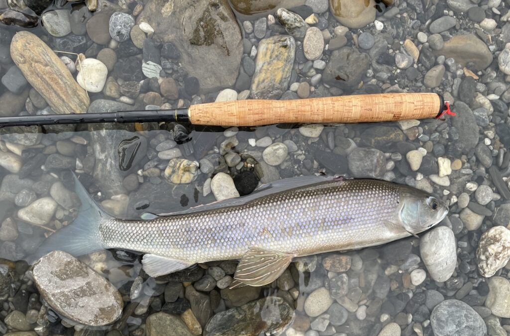
The following morning, we were notified by Kirk that he was unable to fly due to the heavy wildfire smoke on the south side of the range. I have to admit, that we were not disappointed; it was an amazingly beautiful place and we had fantastic weather, the bugs had yet to emerge in full force, and we had planned enough food for a couple extra days. We spend the day exploring the tundra, fishing, and enjoying the wildlife. We watched as a herd of caribou including this season’s young crossed the river, the older animals carefully nudging the young into the swift water and escorting them across. A memory burst into my head of a documentary on Alaska I saw as a child: one segment following the migration of caribou captured the drama of the herd crossing the Canning River. I never would have imagined that I would get to see that in person.
The next day, we spent some time taking stock of our food and also preparing our gear in case Kirk could make it in. It was with mixed emotions when we saw his plane on the horizon that afternoon, I think a couple more days would have been just fine….


Final Thoughts
This trip was all I expected it to be and more: adventure, challenges, beautiful scenery and abundant wildlife. We encountered high turbid rapids with floating icebergs and collapsing aufeis followed by a lazy float on a clear running stream a few days later – all on the same river. We witnessed the manic seasonal transition from the white quilt of winter to a blanket of green speckled with multitudes of wildflowers. Our journey took us through driving rain, sleet, snow, high winds, and lightning interspersed with long warm days with brilliant blue skies.
It is a truly remarkable experience to follow the gathering groups of caribou on their way to the calving grounds on the coastal plain – an instinctual journey that has been repeated for thousands of years. To trace this route with them is to sense something ancient and true.
The breakup of aufeis is intimidating to travel through, yet awesome in it’s power to transform a river. It added a certain level of discomfort to our journey, but it was a phenomena that I am thrilled to have witnessed in person. Timing is everything, as only occasional patches of the thickest ice remained on the upper river when we flew out 16 days later.
The Arctic Coastal Plain should be experienced in person. It is impossible to feel the energy and immensity of this place without actually having your feet in the tundra and marshes, watch a fox hunt, caribou cross a swift river, and listen to constant call of waterfowl and songs of tundra birds. It is heartbreaking to experience this and continue to read accounts penned by developers and exploiters describing this as a “barren wasteland.” “Barren” is a word that is best used to describe the hearts of those that wish to destroy it.
